Posted on

Baldy Rocks

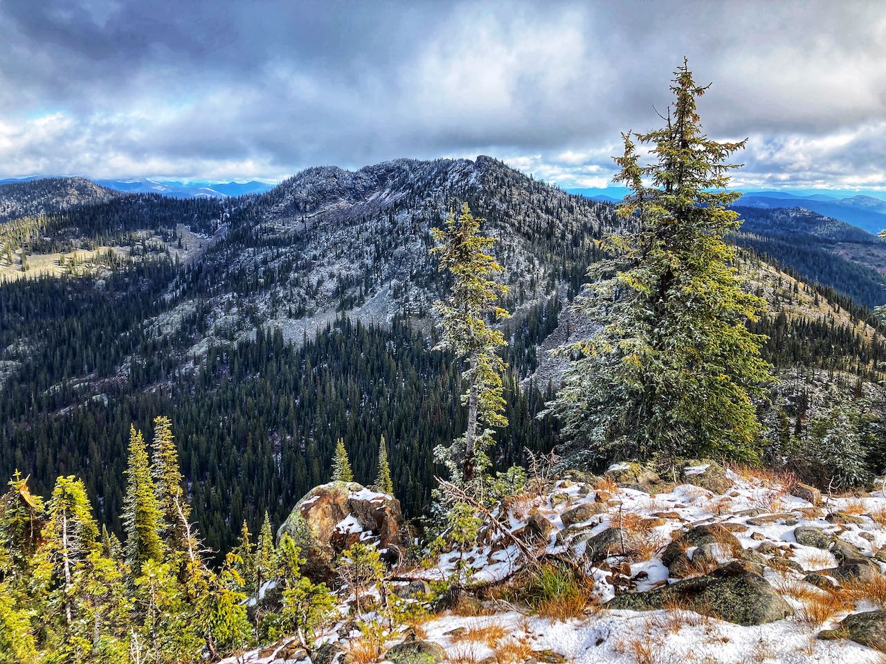
A little bit of bushwhacking will get you over to a new summit on Kootenay Pass. Baldy Rocks offers a new vantage point, looking down over Bridal Lake.

Summary
Trailhead: Highway 3, Bridal Lake
Distance, round trip: 6.8km
Elevation: +375m
Season: late June to late September
Difficulty:  Moderate
This content is for Trail Blazer – Monthly and Trail Blazer – Annual members only.
Login Join Now
This content is available exclusively to members of West Kootenay Hikings Patreon at $10 or more.
Posted on

Haiseldean Lake

A short hike to a quiet subalpine lake, with plenty more exploring on the surrounding ridges. The forest is studded with golden larches in the fall.

Summary
Trailhead: Redfish Creek FSR
Distance, round trip: 7km
Elevation: +407m
Season: late June to early October
Difficulty: Moderate
This content is for Trail Blazer – Monthly and Trail Blazer – Annual members only.
Login Join Now
This content is available exclusively to members of West Kootenay Hikings Patreon at $10 or more.
Posted on Leave a comment

Beattie-White Queen Loop

Mount Beattie and White Queen have individual trails leading to their respective summits… but you can also hike a loop connecting the two! And the best part of the loop is the connection trail leads through a patch of wildflower meadow in the summer and a huge golden larch stand in the fall.

Summary
Trailhead: Whitewater Ski Hill Road
Distance, round trip: 12.3km
Elevation: +680m
Season: late June to late September
Difficulty:  Moderate
Continue reading Beattie-White Queen Loop
Posted on 2 Comments

Mount Beattie

Sometimes you just need a moderate hike with a moderate view. Mount Beattie is like that. It’s a forested ridge line, tucked away in the Whitewater backcountry. Beattie’s treed summits are uneventful, but sometimes the journey is more important than the destination. And a day out in the mountains is never a day wasted.

Summary
Trailhead: Whitewater Ski Hill Road
Distance, round trip: 11.2km
Elevation: +499m
Season: late June to late September
Difficulty:  Moderate
Continue reading Mount Beattie
Posted on 1 Comment

Red Mountain (Bonningtons)

“Red Mountain” seems to be a pretty common name in the Koots. There’s a few of them! But this one is the neighbour of Toad Mountain in the Bonnington Range above Nelson. It has the characteristic red rock, but also offers great hiking off the beaten path.

Summary
Trailhead: Giveout Creek FSR
Distance, round trip: 9.2km
Elevation: +491m
Season: early July to late September
Difficulty: Moderate

This content is for Trail Blazer – Monthly and Trail Blazer – Annual members only.
Login Join Now
This content is available exclusively to members of West Kootenay Hikings Patreon at $10 or more.
Posted on

Grassy Mountain

Grassy Mountain is renown for its winter powder, but it’s also a great summer destination for those that don’t mind hiking off trail. You can explore the ridges which are full of spring wildflowers and offer big wide views of the Bonnington Range.

Summary
Trailhead: Munson FSR
Distance, round trip: 14km
Elevation: +663m
Season: early June to early October.
Difficulty:  Difficult
This content is for Trail Blazer – Monthly and Trail Blazer – Annual members only.
Login Join Now
This content is available exclusively to members of West Kootenay Hikings Patreon at $10 or more.
Posted on 7 Comments

Elephant Mountain Traverse (CBC Tower)

Going up and over Elephant Mountain is a big day. But sometimes that’s just what you need to break in those boots! This is a difficult hike with significant elevation, but it’s scenic and close to home! At each milestone, the City of Nelson shrinks further below and more and more peaks unfold from the distant valleys.

Summary
Trailhead: Pulpit Rock Trailhead or Lyon’s Bluff Trailhead
Distance, round trip: 13.5km
Elevation: +1120m
Season: mid-May to late October
Difficulty:  Difficult
Continue reading Elephant Mountain Traverse (CBC Tower)
Posted on 2 Comments

Summit Trail / Blaster’s Ridge

Yes, you can hike ALL OF THE SUMMITS! Or at least as many as you want. This new trail zig zags up Whitewater Ski Resort to access several peaks on the “summit side” of the hill.

Summary
Trailhead: Whitewater Ski Hill Road
Distance, round trip: 9.5km (to Hummingbird Peak)
Elevation: +521m (to Hummingbird Peak)
Season: late June to late September
Difficulty:  Moderate
Continue reading Summit Trail / Blaster’s Ridge
Posted on 8 Comments

Toad Mountain via Giveout Creek

Hiking Toad Mountain via Giveout Creek FSR leads you along a forested trail to access the summit from the northern ridge. The ridge line ascent is a little less scenic than the original trail from the Silverking mine, but much easier for hikers and vehicles alike! The summit of Toad offers epic views of the Nelson and surrounding peaks!

Summary
Trailhead: Giveout Creek FSR
Distance, round trip: 6.7km
Elevation: +370m
Season: early July to late September
Difficulty:  Easy

Continue reading Toad Mountain via Giveout Creek

Posted on 2 Comments

White Queen (via Hummingbird Pass)

A beautiful hiking trail up to White Queen’s Summit! Follow a historic mining road through Hummingbird Pass to access the “Bird Queen Trail” which traces the ridge line to the summit. Beautiful views of Ymir Peak and the surrounding mountains can be found along the way, but be sure to come in the fall for the golden larches at the top!

Summary
Trailhead: Whitewater Ski Hill Road
Distance, round trip: 10.2km
Elevation: +691m
Season: late June to late September
Difficulty:  Moderate
Continue reading White Queen (via Hummingbird Pass)